From simple schematic layouts to fully textured, scaled representations of real-world locations — we transform your reference materials into compelling 3D visualisations for science communication, engineering presentations, and environmental reports.
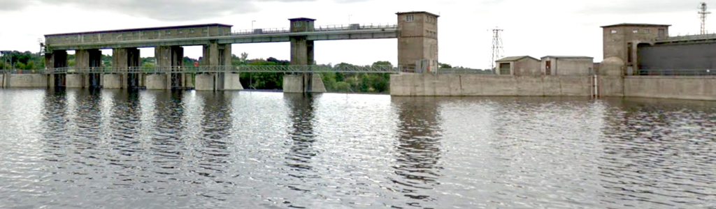
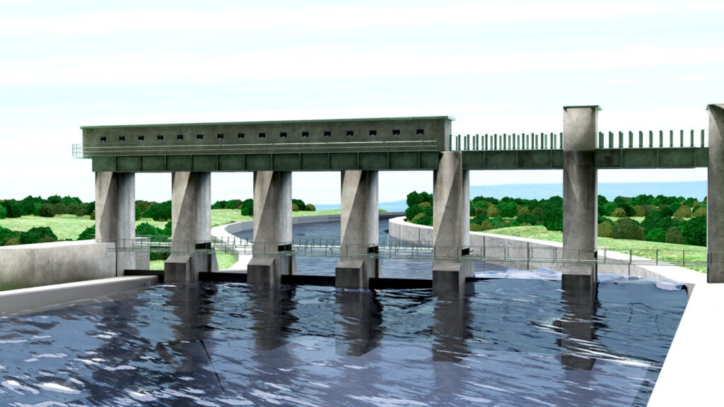
3D environment model of Parteen Weir, River Shannon, Ireland — created for engineering documentation and public communication
What is 3D environment modelling?
3D environment modelling is the process of digitally recreating real or conceptual locations, buildings, infrastructure, and landscapes in three dimensions. The resulting models can be rendered as still images, animated fly-throughs, or interactive visualisations — at any camera angle, time of day, or weather condition.
Science Design Services specialises in environment models for technical and scientific contexts: infrastructure projects, ecological sites, civil engineering schemes, conservation areas, heritage sites, and research field locations.

How We Work
1
Reference gathering
We work from photographs, OS maps, satellite imagery, architectural drawings, site surveys, video walkthroughs, or written descriptions — whatever you have.
2
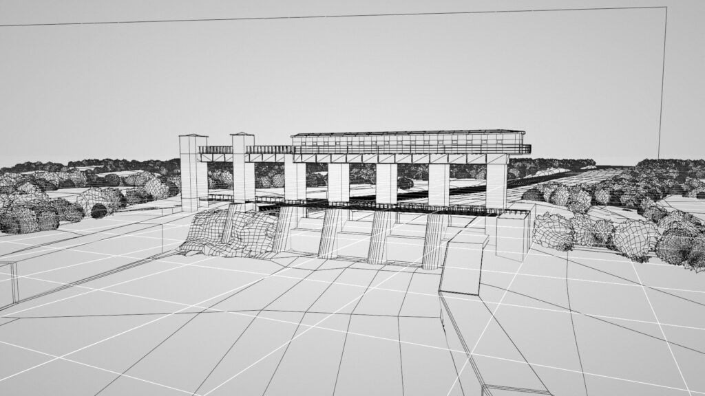
Modelling & blocking
The scene is blocked out in 3D, capturing accurate proportions, structural geometry, and spatial relationships before detail is added.
3
Texturing & rendering
Materials, lighting, atmosphere, and mood are applied. Final images are rendered from any camera position — you choose the angle, season, and time of day.
1
2
3
Who commissions environment models?
Engineers & consultants
Visualise infrastructure, drainage schemes, and civil works for planning applications and stakeholder reports.
Environmental agencies
The next step is blocking out the basic structure. Capturing the overall shape, relative dimensions and any supporting models
Researchers & academics
Reconstruct field sites, archaeological landscapes, or experimental environments for publications and grants.
Science communicators
Create accurate, visually engaging location models for documentaries, museum displays, and public outreach.
Why choose a 3D model over photography?
Real photography is limited by access, weather, budget, and the fact that your project may not exist yet. A 3D model gives you complete creative control: choose any viewpoint, adjust lighting for morning or dusk, show before-and-after scenarios, or zoom into architectural detail that would be impossible to photograph safely.
For proposed infrastructure or environmental change projects, a photorealistic 3D render is often the only way to communicate what something will look like once built.
Ready to model your location?
Tell us about your site — we’ll respond with a timeline and quote within three working days.